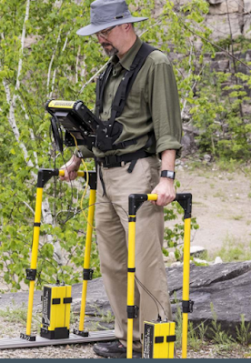
Sensors & Software's instruments optimize GPR technology for users. Products range from the ultimate in configurable such as the pulseEKKO PRO to application focused GPR solutions such as Conquest, specificaly designed for concrete structure imaging.
|
pulseEKKO PRO
The ultimate solution for the GPR professional, pulseEKKO PRO provides user selection of GPR parameters such as frequency, polarization, antenna separation, stacking, sampling rate and more combined with a range of operational configurations.
|
|
Noggin
The Noggin family provides a wide range of operational configurations while keeping the GPR complexity to a minimum. Noggin products are designed as work-horse solutions for a range of standard GPR applications.
|
|
Conquest
Optimized for imaging concrete structures, Conquest's self contained, portable and easy-to-use features deliver quick and reliable results to both cutting and coring contractors and structural engineers.
|
|
Rescue Radar
GPR designed to detect buried disaster victims. Simple and self-contained, Rescue Radar is optimized for use by search and rescue teams.
|
|
SnowScan
GPR for ski resort snow management. Two configurations, handheld or groomer mounted, enable rapid mapping of ski hill snow depth enabling snow management teams to optimize snow making and grooming.
|
|
IceMap
GPR for ice road monitoring. IceMap is optimized to provide real-time ice thickness for the winter road managers in northern climates.
|
|
SPIDAR
The ultimate for custom GPR configurations, SPIDAR's modular components and integrated communications deliver control of multiple GPR systems operating concurrently.
|
|
LMX100
LMX100 Locate & Mark GPR - designed specifically to make marking utilities with GPR simple and easy.
|
|
Utility SmartCart
Tailored for the utility-locating market, Utility SmartCart operates in both Locate & Mark and Survey & Map modes to provide locating, mapping, and SUM/SUE reporting capabilities.
|
|
FINDAR
FINDAR allows police to quickly locate buried evidence for further investigations. The system can be used in a variety of terrains for both rural and urban investigations.
|

Nessun commento:
Posta un commento